• There were many reasons for the change of the site software, the biggest was security. The age of the old software also meant no server updates for certain programs. There are many benefits to the new software, one of the biggest is the mobile functionality. Ill fix up some stuff in the coming days, we'll also try to get some of the old addons back or the data imported back into the site like the garage. To create a thread or to reply with a post is basically the same as it was in the prior software. The default style of the site is light colored, but i temporarily added a darker colored style, to change you can find a link at the bottom of the site.

What iPhone phone app do you use to plan & track your trips?

Allen42

Active member
I use my dashmounted phone for GPS and tracking. (Which has the drawback of overheating and dimming the past couple of weeks, but the voice guidance in my helmet works, so I'm ok with that for now.)

I've tried MyRoute-app, and it would route me through parking lots, dirt lanes, etc. But it did a great job of tracking a multi-day trip, and I could just pause and restart tracking when I wanted.

I tried Rever, but if I got even a little off route, it never actually recalculated even though it shows "recalculating" on screen, but just dinged at me the whole time until I got back on it's pre established route. I also did not see a pause feature on its tracking. And it froze up a couple of times, so i had multiple routes tracked and the end of the trip that I could not figure out how to merge.

So right now, I'm planning on using my go-to's of Google and Waze for route guidance, and MRA for recording in the background.

What do you all do?
 
Last edited:
I am an iPhone user, and I would like to use it with Carplay on my 2024 Spyder, but CAN-AM has still not delivered a working Carplay option.

Currently I'm using a handlebar mounted Garmin Zumo XT motorcycle GPS. It is paired to my iPhone, which I plug into the USB port in the top case, and my helmet has a Sena bluetooth headset that is also paired to the Garmin so the directions are heard throught the headset.

One Carplay is working I may sell the Garmin and switch the bluetooth paring of my iPhone and headset to my Spyder.
 
Last edited:
I don't have or use anything from Apple unless I have absolutely no choice, but I won't go into why I think they're all expensive rip-off toys used to take the money off the unthinking masses! ;) I do have & use a Garmin GPS, but unless I'm actually 'navigating' thru a city I'm not familiar with; or out remote in the bush somewhere that it matters, I generally don't 'PLAN' routes all that much at all! :rolleyes:

And I very rarely, no, EXTREMELY rarely use the voice guidance! :lecturef_smilie: In fact, I think the last time I chose to use that was waaaayyy back when I was doing some pre-production testing for a certain GPS manufacturer whose products I used extensively then & still use today was considering introducing that feature, even before they seriously started developing it and well before it was made available commercially by anyone, let alone became on most GPS units & any GPS type products! Yes, it WAS that long ago! :shocked:

Maybe if I'm aiming to be somewhere particular/specific by the end of the day's ride, or if I want to visit a few points of interest along the way, I might directly load that/them into the GPS as a destination/waypoint; and let the GPS do its thing, displaying (possible :p ) routes, distances, & ETD's etc. But then I just ride (or drive ;) ) in the direction I want to head, basically aiming at where I want to go next and maybe looking at the GPS occasionally to give me a general direction; or possibly to navigate thru a maze of city/freeway interchanges etc; then I might possibly use its guidance to finally zero-in on the next PoI/way-point - but I don't get any brownie points for meticulously following a set route anymore, so if I see a road that looks interesting, or a sign pointing toward a place I think I might like to see, I won't let the GPS direct me otherwise; and the Garmin units that I prefer never have any issue in recalculating a route to my final destination for the day - not that I watch them all that closely for that sort of direction anyway, but certainly by the time I next look at the GPS to get the general direction of where I'm aiming to end up, there's never any issues with showing me that! :thumbup:

However, all that said, I almost always have the GPS on showing me the next couple of miles ahead of whatever road or track that I'm currently on - and not only do I LOOK as far ahead as I can see & scan back down the road ahead, planning the path I want to take; I also use the GPS to keep an eye out for where the road goes beyond my immediate view, looking at the curves & corners I'm approaching, any sharp turns ahead, narrow bridges, other highlighted potential issues, etc, etc; and the Garmin GPS's that I use are ideal for that - on the Spyder, it's the Zumo 660. I just include the GPS screen in the regular momentary scan I do of all my controls, mirrors, & instruments, so it becomes just another tool that I use to help make my riding safer, faster, and more enjoyable - it's certainly not something that I put any great deal of effort or thought into programming or route planning or anything else! I just use it to help make things easier, and if it doesn't, like most of the 'GPS' phone apps & 'route planning' apps that I've seen, I don't have the time or the energy to waste on that sorta crap these days! I'm RIDING ffs, not plotting a Special Sea Dutyman Blind-Pilotage Approach into one of the World's Busiest Harbours in a ship carrying enough highly explosive material to blast said ship, harbour, city, and maybe even country off the face of the planet if I follow an incorrectly plotted course or make a wrong turn!! :yikes: :banghead:


A phone is a communication device that's also a toy loaded with lotsa bells & whistles & shiny things to keep the kids occupied; while a GPS is a simple but serious and very smart TOOL - don't over-think it, just USE IT! :bdh:
 
Last edited:
Peter, your posts always make me smile. I sure wish you had opinions, and would share them. ;)

Here way across the pond, in the metros of Texas, getting anywhere requires a map of some sort. And yes, I much prefer to follow the line generally than being told what to do. But in the city, I also prefer to keep my eyes on traffic rather than on my dash. (Although I've switched my voice to a sexy British female accent to make it more bearable. :yes:) My $1100 mini portable pocket computer that also takes phone calls that has an amazing display (when not overheated in today's 101f temperature) provides several solutions for that, and that's what I now choose to use.

I had Garmin when they first started making auto GPS and used them exclusively in my cars until smartphones became ubiquitous.

And before that I used paper maps. First, supplied from Atlas, AAA, or highway travel stops, then printed from MapQuest via my Prodigy account. But times change. And now I find that the paper maps that are always hard to refold properly, are even more difficult to re-fold on the bike at 75 mph! roflmao

P.S. I asked this question, because for the first time EVER, I'm taking a "me" trip, with no kids or significant other. 5 days of riding, beaching, and enjoying myself. I am super duper excited about it, and also a little nervous, because, like I said, this is a first in my life. (Hint: my youngest child is now 24.) I have made each night's reservations, and would like to make sure I arrive there, and would like to log my route and write up a nice trip report when I return.
 
Last edited by a moderator:
Peter, your posts always make me smile. I sure wish you had opinions, and would share them. ;)
.....

Are you implying I expressed an OPINION?! :yikes: Whaddaya meen?! :dontknow: I worked REEELLLY hard to take all of them outta that post!! Nuffin' but Faxx in there! :lecturef_smilie:


;)
 
I use Waze in all of my vehicles, when needed anyways.

Works great on my iPhone 15 and integrates seamlessly with my helmet intercom on the Spyder or my motorcycle.

It's not perfect but its close enough.
 
I've been using Scenic for a few years now. It works for me.

I just used Scenic today and am on their 14-day trial. It seems like it does everything I want pretty well so far. Thanks!

I use Waze in all of my vehicles, when needed anyways.

Works great on my iPhone 15 and integrates seamlessly with my helmet intercom on the Spyder or my motorcycle.

It's not perfect but its close enough.

I use Waze for routing, but it doesn’t track, record, and publish route stats after the fact; not that I’m aware of, anyway.
 
Last edited by a moderator:
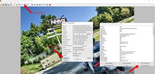
For those that use Garmin products for GPS you can upload tracks from your GPS to BaseCamp. Export the specific Track file from Basecamp which will create a ".GPX" file. This info will tell you where you have been by GPS Coordinates. I use a Zumo XT and a Nuvi 1490 (this use to be my main one) when riding. I upload the tracks from the Zumo (same as it would be for the Nuvi) to capture the info. I then use another program which uses the GPX file created from the "tracks upload" file that matches the date stamp and time stamp in the photo file to the GPX files time stamps and embeds the GPS coordinates into the EXIF info of the photo photo. This enables one to see where you took the photo right from the photo. I use IrfanView as a quick viewer of photos, it contains a button that automatically links google maps which when clicked will PIN where you took the photo in google maps.

The program I use to get the timestamp match and embedding the GPS Coordinates is GeoSetter (free for the download).

While I don't have experience with other brands of GPS's (started with Garmin with a Street Pilot 2610 since 2006) my guess they also have a TRACK upload function as well.

If you want more detailed "how to" let me know.

Sample of Viewing a Photo via IrfanView program (free for the down load)
Capture using Irfanview.jpg


Willie
 
Rever. Works great and will record your route on the fly.

I found these issues with Rever, you don't have the same issues?

"I tried Rever, but if I got even a little off route, it never actually recalculated even though it shows "recalculating" on screen, but just dinged at me the whole time until I got back on its pre established route. I also did not see a pause feature on its tracking. And it froze up a couple of times, so i had multiple routes tracked and the end of the trip that I could not figure out how to merge."
 
Garmin Zumo XT, I frequently ride in areas with no cell phone reception. In eastern Pennsylvania no road runs straight for very long, so going by guess and by golly can get you very nicely lost.
 
Garmin Zumo XT, I frequently ride in areas with no cell phone reception. In eastern Pennsylvania no road runs straight for very long, so going by guess and by golly can get you very nicely lost.

Many of the phone apps now have offline protection, where they can automatically download the map data for your route, or you can manually do so.
 
Now that I have Apple Carplay working correctly on my 2024 Spyder, I am using the Maps application on my Apple Macintosh computer to plan my routes, which I can then upload the routes to the Maps app my Apple iPhone, which is what drives (excuse the pun) the Apple Carplay Navigation running on my Spyder.
 
Back
Top